


MGB explains city’s ‘90% landslide prone area’
2 MIN READ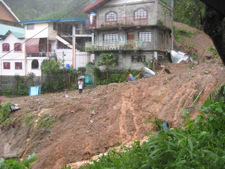 “Due to its geomorphic (mountainous) and geologic (seismically active) character, the whole of the Cordillera Administrative Region is prone to landslide. Photo by Brenda Subido-Dacpano” title=”bagyo 036″ width=”450″ height=”338″ class=”size-full wp-image-5473″ />
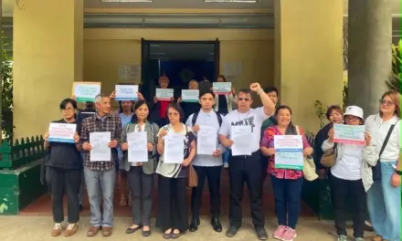
By WENDY ATUBAN
www.nordis.net
“Due to its geomorphic (mountainous) and geologic (seismically active) character, the whole of the Cordillera Administrative Region is prone to landslide. Photo by Brenda Subido-Dacpano” title=”bagyo 036″ width=”450″ height=”338″ class=”size-full wp-image-5473″ />Due to its geomorphic (mountainous) and geologic (seismically active) character, the whole of the Cordillera Administrative Region is prone to landslide. Photo by Brenda Subido-Dacpano
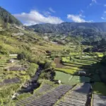
BAGUIO CITY — This city is after all not that all too critical in terms of landslide susceptibility but it is landslide prone nonetheless.
Due to its geomorphic (mountainous) and geologic (seismically active) character, the whole of the Cordillera Administrative Region is prone to landslide.
That is what the Mines and Geosciences Bureau (MGB) clarified during the weekly kapihan on Wednesday here. Unnecessary alarm was raised stemming from an earlier report that 90 percent of Baguio City is a critical landslide area.
MGB engineer Sarge Gacad said, “the 90 percent was a summation of the landslide prone area” but that does not mean all the 90 percent is critical, which in the classification of the landslide susceptibility map of the MGB, is the top most in the hierarchy or the most hazardous.
The 90 percent summation, explained MGB geologist Faye Apil, consists of the critical, highly susceptible, moderate, and low landslide susceptible areas in the city. Part of the designated landslide critical areas are Quirino hill, Rock Quarry, Holy Ghost and Quezon Hill, while Burnham, Mirador, Loakan and San Vicente are endangered of not only landslide but ground fracturing as well, due to the earthquake fault line running beneath them.
The latter four places are considered the four zones of weakness due to earthquake fault underneath them. These zones of weakness experience high vibration during earthquakes because it is here where energy is released.
Despite this fact, the MGB sees no cause for alarm as they are about to complete the susceptibility study of the whole region. Apil impressed the study serves as “guide to know appropriate development and to identify areas that are appropriate to build structures in.”
Gacad hastened to add, when “there are certain susceptibilities to a certain hazard [of an area], there are [corresponding] certain vulnerability.”
MGB regional director Samuel Paragas thinks effort must be poured in for more information campaign in the communities about the landslides. He added, they won’t allow people to live in high risk areas. # nordis.net